mappatore dev
A simple and fast Shiny interface written in R that can be used to show some public WMS services along with a minimal set of drawing tools
Features
- Showing different WMS services at the same time
- Converting coordinates between WGS84 and UTM32
- Drawing polygons and lines and make measures
- Reverse georeferencing
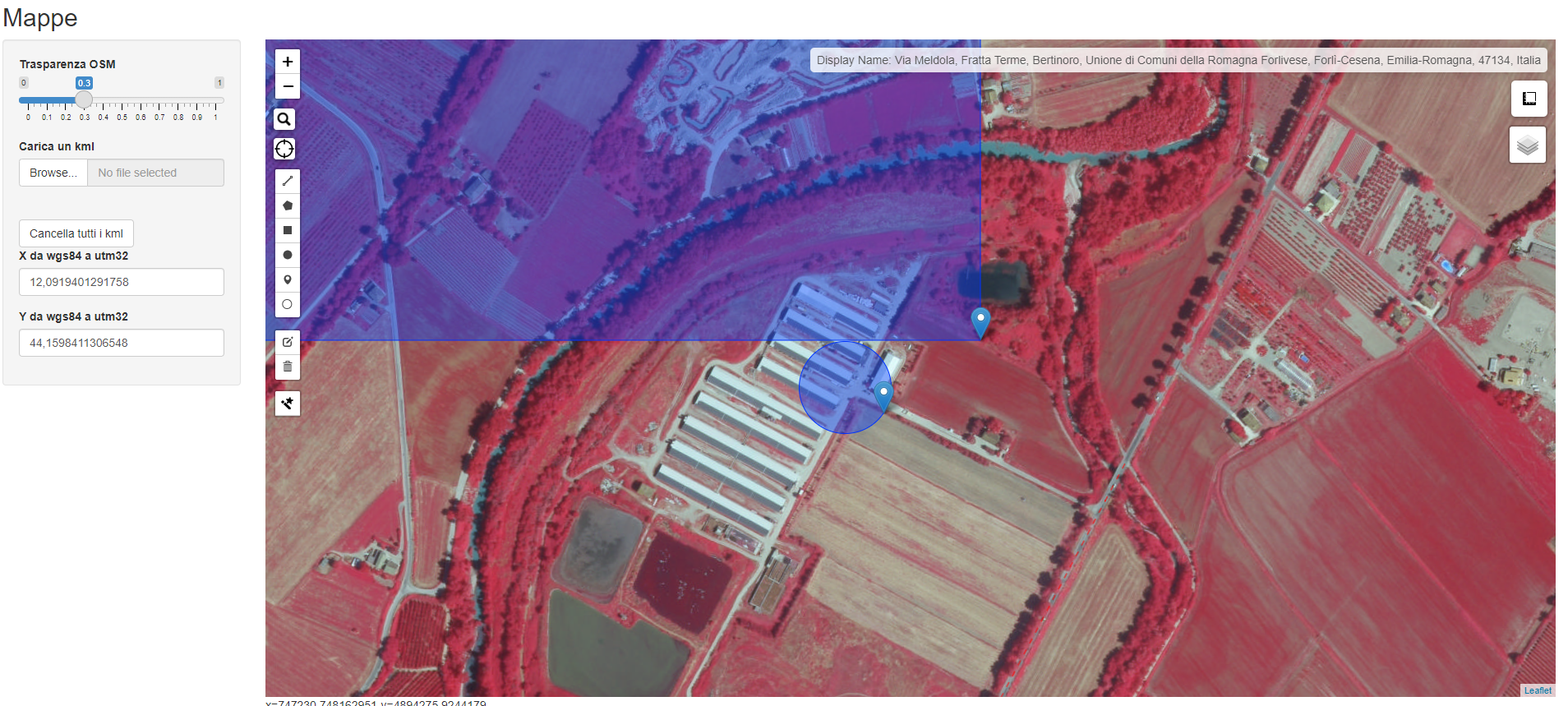
Screenshots
Description
Mappatore is a simple and fast Shiny interface written in R used mainly to show public WMS services. The simple code is very easily editable to add more WMS services. It also allows the user to upload a kml file and plot it along with the already shown WMS layers. The main use is to provide a very fast and simple small online GIS that can also be used in the field by all the operators who need a map on the fly with different reference layers. It also provides a very simple way to translate coordinates from geographical (WGS84) to UTM32. When used in the field from a smartphone or tablet it automatically brings the user to his/her position and it can be used to reverse georeference any point on the fly. An implementation of it is available freely at: https://arpae.shinyapps.io/mappatore/